Monday, May 27, 2019

Beautiful Bosnia

Every mountain we climb has a story, this one began with Sergei the Bosnian-speaking National Park guide saying “the mountain is not safe to climb right now.” 
The translations continued with  “...the cables (meaning via ferrata-type hand rails for safety) are buried under the snow and I will go with you to the cables but I won’t risk my life so I won’t go any higher.” 
Maglić is the highest mountain in Bosnia & Herzegovina at 7,828 feet and she sits on the border with Montenegro to the east within the scenic Sutjeska National Park.  We knew climbing it in May would involve steep snow slopes and we came prepared with crampons and gear to give us the best chance to reach the summit, which was after all one of our main reasons for visiting this country in the first place.  Arranging for a guide many weeks in advance was another measure we took so we could have somebody to help with route-finding and to generally increase our safety and chances for success. 
So when we heard Sergei say the mountain isn’t safe and he didn’t want to go, we had a decision to make.  It was a fairly quick and easy one for us actually, especially after learning that this man (despite his strong, rugged and hardened-looking appearance) was actually a “tourist park ranger” and not a true mountain guide. Through our translator friend at the hotel, we thanked Sergei for his time and told him we had climbing experience and that we would head up Maglić on our own. 

Fortunately back at home before the trip I had downloaded detailed topo and satellite maps of the mountain and the climbing routes. With my new Gaia GPS app on my phone, we successfully navigated 12 miles of dirt roads, found the correct trailhead and from there the two of us headed on foot towards the snowy flanks of Maglić! 

The weather was perfect, clear blue skies, sunshine, pleasant 40 - 50 degree temps and no wind. We were quite fortunate to have clear skies in order to find the route visually from afar rather than rely solely on maps and GPS.  This was particularly  true when trying to navigate our way up the imposing rock fortress like wall of more than 1,000 feet. We needed to get up this somehow in order reach the ridge, and I knew there was a way, but without a guide it would be much more challenging.  Luckily we ran into a group of climbers from Macedonia and Serbia who had a guide familiar with the way up to the ridge.  We chatted for a bit, he pointed out the way and then we went ahead since they were a large group so we were able to move faster with just the two of us. 

As we climbed higher we reached the point where our would-be guide Sergei was talking about with the cables being buried under the snow. We clearly understood the reason for bolting the cables in thatparticular spot.  ...there was a seriously steep slope where a slip would result in plunge over a cliff of several hundred feet down to the rocks below.  
After studying our options we decided that the safest way across was climbing on the rocks above the slope to get as far as we could and then wedging ourselves into the bergshrund to traverse the rest of the distance.  We repeated this process again for several other similar crossings and did some straightforward climbing up over rock and snow until we reached the top of the ridge.  After four hours and over 
2,500 vertical feet we reached the summit and were standing on the highest point in the country of Bosnia & Herzegovina!


Stark Most: Old Bridge in Mostar destroyed in 1990’s civil war and later rebuilt. 
Blagaj Tekija: 15th Century Dervish Monastery


Wednesday, November 14, 2018

Crazy Cambodian Climb

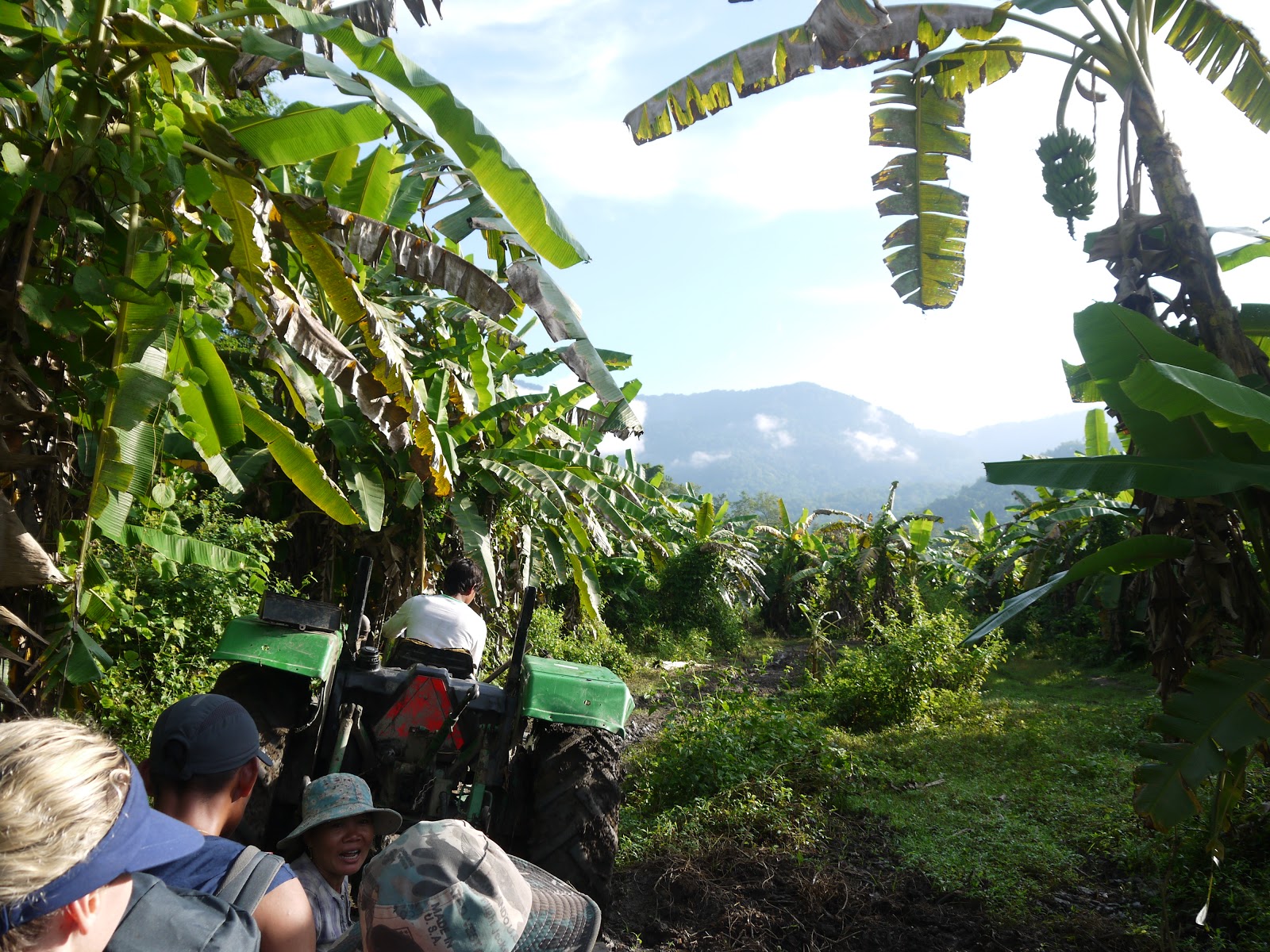
Phnom Aural is the highest mountain in Cambodia that very few people ever visit or climb because it is extremely remote and involves difficult logistics and a trek through the jungle to simply get to the base.  It's also not very high at only 5,948 feet so reaching the summit almost seemed like an unworthy challenge.  ...until Denise pulled off the second blood sucking leech attached to her leg! This was after starting the first day at 4:30 AM wearing clothes and a backpack that were dripping wet from a large puddle that formed inside our tent from an unexpected overnight rainstorm.  Despite the leeches, wet clothes, mud, heat and humidity, we were actually having loads of fun the majority of the time and appreciating the lush beautiful scenery and the means by which we were transported to this isolated corner of the world. Due to the severely rutted and otherwise impassable dirt "roads", we arrived at the foot of the mountain by way of two separate tractor rides, one from a local rice farmer and the other from a logger.

Another good reason for our good humor in the midst of the adverse conditions was our guide Phanina. We were extremely lucky to find him and when we first met at the bus station in Phnom Penh, his warm welcoming smile and giddy enthusiasm convinced us we were in good company.  
It's not often he gets to guide clients up this mountain due to lack of interest, so he considered it a privilege and genuinely seemed excited to be on this adventure with us. Aside from a few blog posts, there is very little information 
online about climbing this mountain so if you happen to be interested please feel free to contact Phanina directly, his email is kimphanina@gmail.com or call him on Skype at kimphanina.  His English is excellent and he is also a knowledgeable professional guide for the more typical tourist sites like the Killing Fields and Cambodia's crown jewel - Angkor Wat. 


Back to the mountain; although there are absolutely no trail signs whatsoever, after wading across several small rivers and pushing through the jungle we reached the "trailhead" at an altitude of less than 700 feet above sea level.  We spent about 3 1/2 hours climbing up to a high camp at approx. 3,795 feet. There were a few steep sections where Phanina's friend had previously attached some ropes on a prior trip, and luckily we didn't encounter any more rain of significance to make the slopes and tree roots underfoot any more slippery and dangerous.  

Once at camp we had a rest and some lunch, set up our tent, re-filled our water bottles and continued on to the summit. Unlike most peaks we have climbed where we are well above the tree line, in this case we were within the heavy tropical vegetation so there wasn't much of a view from the top.  ...but there was a small pagoda and statue of Buddha.  
We paid our respects, took photos and were back down to our high camp in 3 1/2 hours where we ate some hot onion and vegetable soup and went to sleep. During the trek back down the next morning we were treated by the sounds of birds and cicadas and the eerie sound of Great Hornbills flying overhead.  It became quite hot near the base of the mountain when we were no longer shaded by the jungle canopy but a dip in the river cooled us off and it was a perfect conclusion to a Crazy Cambodian Climb! 
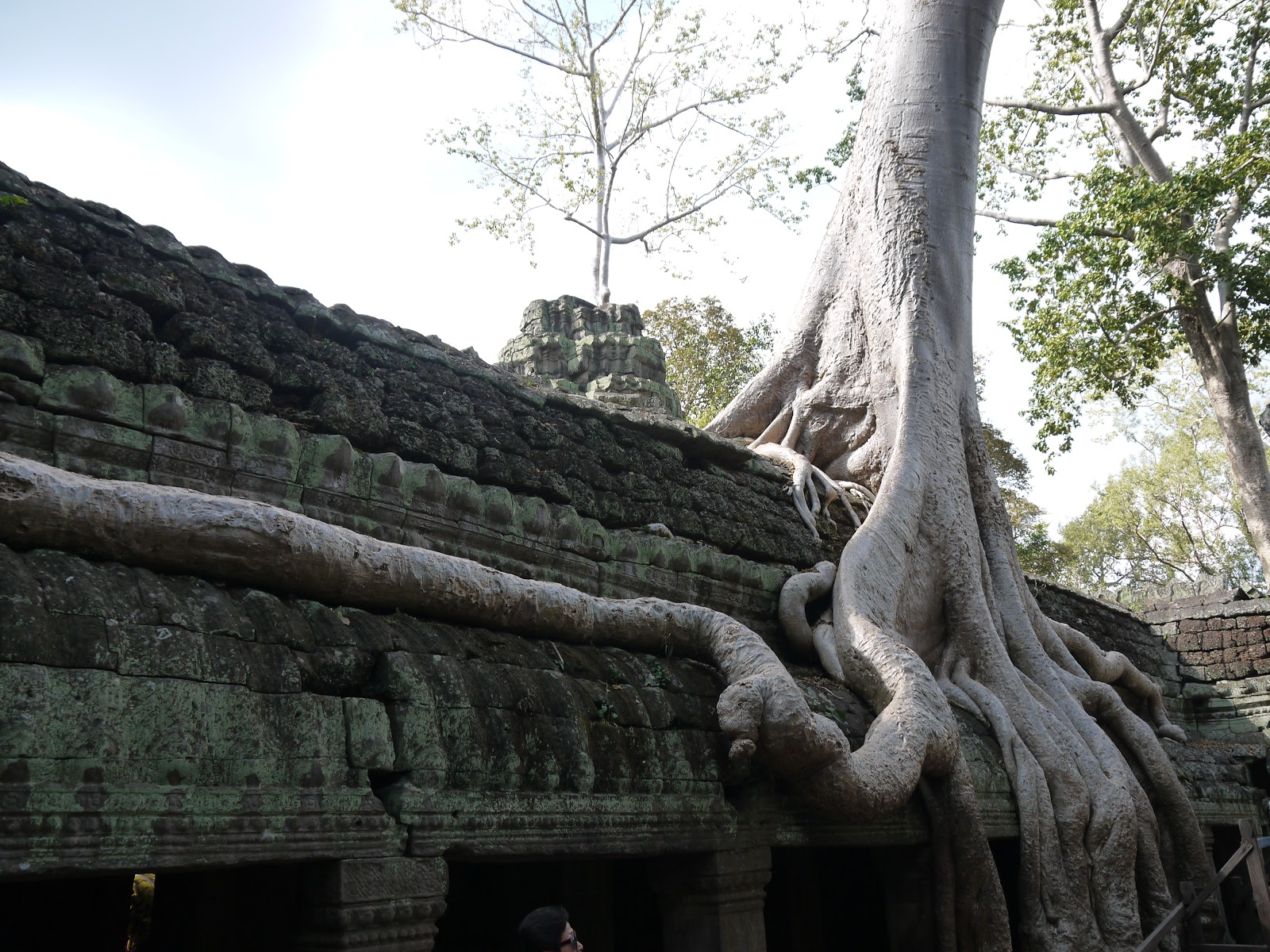
No trip to Cambodia can be considered complete until visiting the temples of Angkor Thom in Siem Reap. The most famous of which is Angkor Wat, the largest religious building in the world. And of course the tree roots overgrowing the temple Ta-Prohm best known as the location for the 2001 Angelina Jolie film Tomb Raider. 


Thanks for reading and signing off from Siem Reap.  Until the next Summit for CAF adventure...

-Paul & Denise

Monday, November 5, 2018

GOOD MORNING VIETNAM!

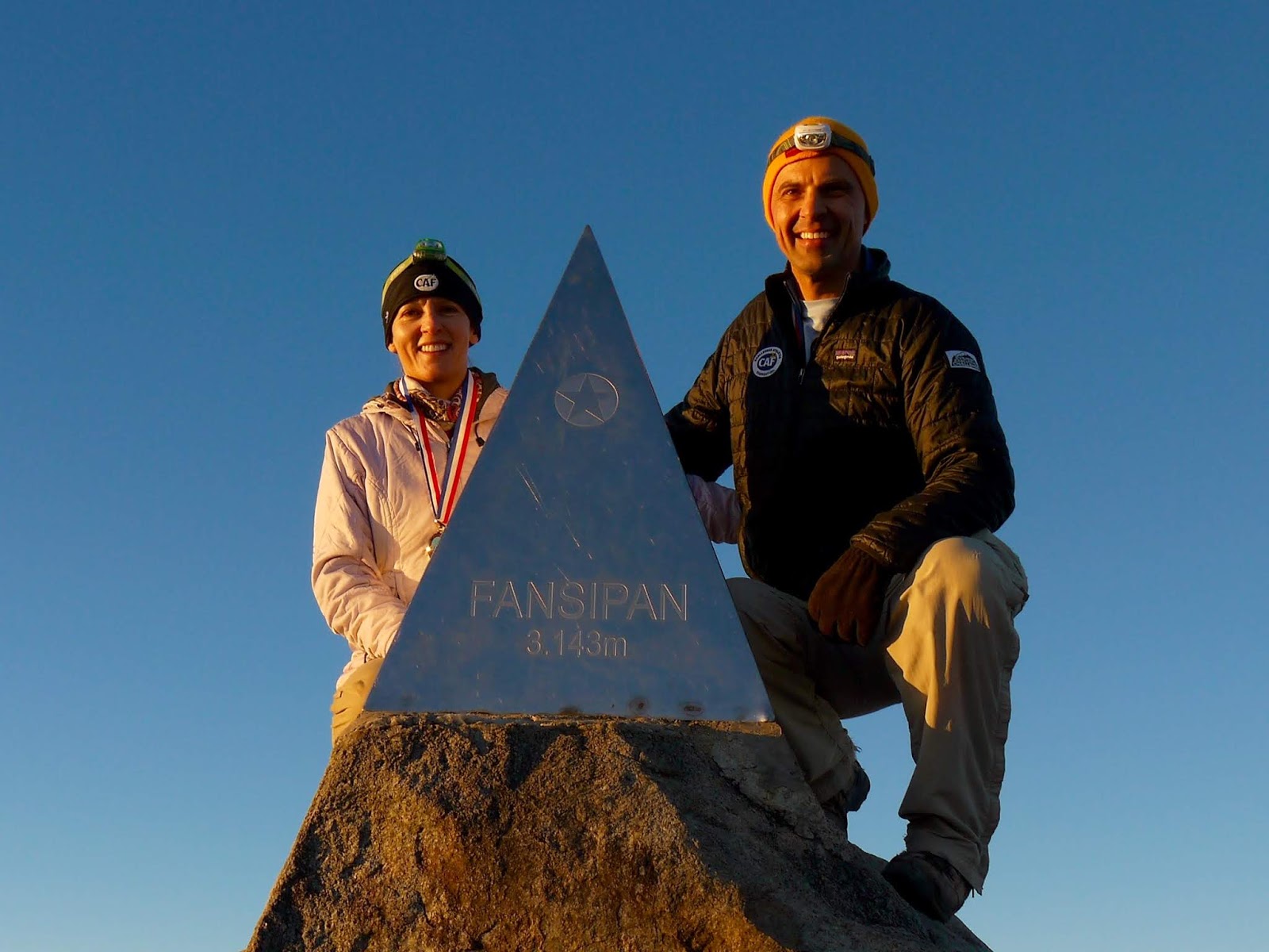
Xin Chào from Hanoi!  At 10,312' Fansipan is the highest mountain in Vietnam and also the highest on the Indochinese Peninsula. In addition to wanting to see the beauty of Vietnam up close (and get a good bowl of Pho) we decided to come here to climb it!  The hike was about 5,400' vertical from the trailhead and took us two days with an overnight camp.  We woke up early Saturday and left our hut at 4:15 AM in order to reach the summit to view a stunning sunrise.  


Two years ago the government of Vietnam invested $2 Billion to build the world's longest three-rope cable car and an enormous complex on top of the peak, complete with elaborate temples and a 71 foot tall statue of Buddha.


Although the tram would have been a much faster and easier way to get to the top, we enjoyed the challenge of the trek up but decided to save our knees some punishment and opted for the luxurious cable car ride back down. 

After reaching the town of Sa Pa we made our way back to Hanoi to meet our friends Bryce and Camille and then continued to the coast to board an overnight cruise on a junk in the famous Halong Bay. We lucked out with a fun, international group of Brazilians, Argentinians, and two Bulgarians.  We kayaked together, swam, hiked, explored caves, enjoyed cocktail hour, great food and even Tai Chi exercises this morning on the top deck of our boat. 


A Good Morning in Vietnam has turned into several great days and more ahead!  RIP Robin Williams, thank you for all the laughs and especially your many years of enthusiastic support of the Challenged Athletes Foundation!

Wednesday, August 15, 2018

Brazilian Biker Wins Hearts ...and a Buckle


2,256 miles driven through 6 states during 13 memorable days, with 289 miles of mountain biking, 2 Colorado 14,000' peaks, and 1 belt buckle.
These are merely the stats of a journey that cannot be quantified in terms of pure joy, inspiration, and countless smiles created across two continents. This journey began for Thiago Ribeiro in Brazil but concluded for me with a bond of friendship and shared purpose that will undoubtedly last a lifetime. Thanks to the Brachial Plexus Nerve Injury support group UBPN, Thiago reached out to me online five years ago to share his story about his brachial plexus injury (BPI) that was sustained at birth to his right arm, just like mine. That single message set into motion a series of events that changed both of our lives. We compared notes (all via FB messenger) about our childhood, the fact we both played drums and loved riding bikes, and that until adulthood neither of us ever talked about our injury. We always tried to hide our arm in public, keeping it in a pocket or behind our back so our difference and perceived deficiency compared to others wouldn't be exposed.
Fast forward to Saturday Aug. 11, 2018, Thiago Ribeiro exposed to the world what he's really made of, and crossed the finish line of the toughest single-day bike race in North America - the Leadville 100. Starting at an elevation of over 10,000' and climbing over 12,000' throughout the course winding through the Colorado Rockies, Thiago finished 298th out of 1,535 racers. Due to race rules he had to start at the back of the crowd but managed to pass and finish ahead of more than 80% of the tough abled-bodied competitors. Riding a wheelie across the finish line at an impressive time of 9 hours and 17 mins, Thiago was awarded the coveted Leadville 100 MTB belt buckle for simply finishing the race in under 12 hours.
I have both Thiago and "One-Arm Willie" Stewart to thank for helping me with my own bike handlebar modifications and for providing the motivation so that I was able to earn the same belt buckle myself three years ago. (See "Brake"-through Mountain Bike Modifications post & video).  Most importantly it was all thanks to the Challenged Athletes Foundation for providing Thiago a grant to travel from Brazil, an entry spot into the race, and amazing support along the way.
In keeping with the theme of this blog, while Thiago was climbing towards his summit, Denise and I carried the CAF banner to the summit of two of Colorado's 14,000' peaks: Mt. Sherman at 14,036' and Mt. Massive at 14,421' (the 3rd highest peak in the contiguous United States).
Thiago would have joined us but he had to attend a mandatory athlete pre-race meeting one of the days and for the second peak his legs, lungs and liver were in recovery mode after the race and post-race celebration party.
Thiago and his bike (and his shiny new belt buckle) are now all safely back home in Brazil, but he will remain in our thoughts and in our hearts until we meet again! Keep riding and making a difference my BPI Brother!

Wednesday, May 30, 2018

Magical Adventure in Morocco

After our "Top to Bottom" tour of Jordan, we headed west to a country that we have wanted to visit for years - Morocco!  We arrived in Marrakesh on May 23rd and have spent the past week enchanted by the Arab and Berber people and their exotic kingdom.  The main square of Marrakesh is called Jemaa el Fna and is a circus-like atmosphere complete with snake charmers, acrobats, storytellers and a large souk similar to what we experienced a few years ago in Istanbul at the Grand Bazaar.  After 2 1/2 days exploring the city and sampling the Moroccan cuisine, we headed south towards the High Atlas Mountains and our objective, the 13,671 foot Jbel Toubkal, the highest peak in Morocco as well as the highest in North Africa.  

We met our guides Mohammed and Omar in the tiny village of Aguersioual and began our trek at 5,280 feet. After 7 1/2 hours taking in the sights and mountain villages along the trail, we reached the refuge beyond Tizi Oussem at 7,425' and spent the night.  


Early the next morning we were treated to views of several beautiful waterfalls and later tormented by 99 switchbacks painstakingly taking us up to the Tizi Aguelzim Pass at 12,045 feet.  It was here where we caught our first glimpse of Jbel Toubkal and then began our descent into the valley down to ~10,500 feet.  We arrived at our campsite near the
Toubkal Refuge approx. 9 1/2 hours after our trek for the day began and just as the afternoon clouds arrived as well.


At 3:30 AM on day three of our trek, our alarm woke us signaling the start of a long and taxing day.  Along with our headlamps the stars and moon illuminated our route.   A cool breeze motivated us to keep moving upwards toward the point where the rays of the sun finally reached us and began to warm our chilled bodies.  

We eventually reached the summit of Jbel Toubkal just after 9:15 AM on Memorial Day in the U.S. Mon. May 28th.  We proudly raised our Challenged Athletes Foundation banner after high fives all around with our team for a successful summit of the highest peak in Morocco!  


The hike back down to basecamp and eventually to the village of Imlil totaled a bone jarring and muscle numbing vertical descent of over 8,000 feet.  By the time we reached our hotel for the night we had been on the move for more than 15 hours and were ready for a long overdue shower and a return to sleeping in a bed.  As tired and depleted as we felt, it made us appreciate the strength and fortitude of our guides Mohammed and Omar who were fasting from sunrise to sunset the entire trip as Ramadan continues.  Yet again traveling to a new country as unique as Morocco and experiencing this adventure has broadened our horizons and reinforced our gratitude for our freedom and ability to explore mountains around the world to support the mission of CAF.